Friday, November 30, 2007

Road Hunting

Since I haven't been able to get out in the woods for rock pictures, I thought I'd take a quick ride today to look at a different area. I have a new lead on a site southwest of here, so I thought I'd take a ride over there, just to look from the road.

It's on a road that, years ago, I used to drive on pretty frequently, but I haven't been over there in at least 8 years, so I was happy to take a ride there.

Going north on the road, and down a steep hill that faces west, I just about jumped out of my seat when I saw this, right along the road:


And just a few yards down the road from that one was this one:


The picture quality is not that great because I took these pictures from my truck and it was late in the day. They are not on public land. But, there you have it - I've gone from not having seen any split-wedged boulders at all to having seen 3 in less than a month. And now, after seeing these 2 very nice examples (and having some input from an expert in the field), I am convinced that the other one I saw in Arctic State Forest is not natural!

Tuesday, November 27, 2007

A Slow Down

Big game rifle season has kept me out of the woods for rock pile photos lately.

I did manage to visit Arctic State Forest right before the season started. This is an area that I am not very familiar with, but I have some theories about why I think I should be able to find rock piles there, as well as one lead...that there is at least one large cairn there.

I didn't get very far into the woods because of the thick underbrush - mostly 5 foot high blackberry bushes. But, down the southwest side of the high peak, I did find some interesting stone features.

This boulder is the closest thing I have found to a split wedge boulder. However, due to the similar type of rock in the wedge, it seems as though this is an entirely natural feature. I finally made my 1/2 meter stick, so I thought this would be a good place to show it off:


I was trying to find a way to get good pictures of the rocky ledge that I just walked down. It was so thick, I couldn't get a good photo of it from a distance:


So, I walked in a little closer and found some interesting features:


That was as close to that natural cave as I wanted to get. I was feeling quite closed in at that point, realizing that if something came bolting out of there, I really had no place to run except straight through the briars, which wouldn't be very fast. After repeating three times "I've got to get out of here" (I failed to click my heels together, which was probably my downfall), I started to leave. I snapped one more boulder picture, but I don't remember why...


...because right after that, 2 of my dogs messed with a porcupine and it was off to the vet's office!!

Friday, November 16, 2007

One end of the stone wall

I took some pictures of the end of the stone wall, that is closest to the dirt road, as well as some interesting features of the wall, between the end and the wall bulge.

Here is the end of the wall:


There is also a rock pile right next to the end of the wall. I can't tell if the stone pile was part of the wall at one time, or is meant to be a separate pile, but was damaged. I looked all around for more stones running in the direction of the wall, toward the road, but I didn't see any. The pile doesn't have much form, so I guess that's why it confused me. If it is colonial, why isn't it part of the wall? If it was part of the wall, but, say, destroyed by heavy equipment, why didn't they just drive around it, where there are no stones? (it's very flat right there). Or, is the rock pile left there exactly as the builder left it? It seems to have a niche like structure in it, which could be ceremonial.


Close up of what looks like a niche:


And here's a view of the entire thing - rock pile in front and end of stone wall to the back:


Here are just a few interesting features of the stone wall, closer to the wall bulge. The first two are possible apertures:


This shows a nice upright stone leaning against the wall:

Thursday, November 15, 2007

Click this for a link to pictures of Michigan cairns

You have to scroll all the way down to the bottom to see the photos of the cairns. If you click on the photos, they enlarge a little bit. According to the MSU website that these photos are posted on, the cairns were destroyed in the 1950's.

Sunday, November 11, 2007

More from the Masonville Cairns

I also revisited the cairns in the Delaware State Forest. Now that the ferns have died off, they are easier to see. Actually, I can't believe what I missed on the Southeast end of the cairn field. There is a small knoll that protrudes out, in the middle of the cairns, and you are able to see 5 cairns from one random spot on the knoll. Additionally, if you move a bit to the Southwest, you can see the wall bulge. Another small, low cairn lies to the North-Northeast, which is not visible from the knoll. That makes 6 cairns at the Southeast end, 4 at the Northwest end (near the spring), 2 rock piles (one spread out on the ground) and a wall bulge.

One of the rock piles makes something like a pile-gap-pile structure, which includes one of the cairns. The rock pile spread out all around, on the ground, I don't know what significance it has, or if it is evidence of some destruction.

For this post, I am just putting up pictures of the rocks all around on the ground and the pile-gap-pile structure, including the cairn in the pile-gap-pile.

Here are some close up pictures of the rocks all around on the ground:


This picture tries to capture the entire view of the rocks all around the ground:


The stone wall, that the wall bulge is part of, is in the background on this photo:


You can see the large cairn, that incorporates the pile gap pile feature, in the background on this photo (the rocks all around the ground are in the foreground):


Here are some photos of the pile gap pile. The first one shows some cut pines that were disposed of on top of the rock pile:


The side of the cairn next to the pile-gap-pile has an opening in it that faces the rock pile. This includes a rock on the ground that acts almost like a doorstep to the cairn entryway. No disrespect was intended with the photo of the measuring stick in the opening. I clearly voiced this at the site. I gently place the 4 ft measuring stick to get an idea of how far back this opening went.


I think it is a pretty amazing feat of construction to have such a large cairn, with such a large, open space at the base, and not have had it collapse after all of these years.

Friday, November 9, 2007

The Wall Bulge - a better view

I also went back to the wall bulge, which is on the stone wall that runs to the steep bank. I took some photos, now that the leaves are off the trees, and I also checked it out from the other side of the stone wall.

The wall bulge:


And this is on the opposite side of the stone wall:


A nice Manitou stone! This photo shows how thin it is:


The Manitou stone against the stone wall seems to match the stone on the opposite side of the wall bulge (in the second photo), but I did not get a good photo of the thickness on that stone.

This wall bulge is close (225 feet) to the large cairn site, and also is between the large cairn site and the steep bank with all the stacked stones and boulders. As a matter of fact, I went out to see the large cairns with a friend and we could see the wall bulge from the western most cairn. The wall bulge looked like another cairn from there.

I am going to post some more photos of the large cairns, on the Southeast end of the cairn field. The Northwest end of the cairn site will have to wait for more photos until the leaves die off of the wild blackberries. I really can't believe it's November and they still have green leaves on them!

Thursday, November 8, 2007

View from the top of the Mountain

At the top of the bank, or mountain, really, there is a stone wall. The stone wall is somewhat snake-like, so I got a general direction on it by waypointing two spots and putting them on a map at home. It runs West Southwest at 255 degrees. The view from the corner, overlooking the opposite direction of where I walked, looks like this:


That picture overlooks an area that has been clear cut and also quarried by the State. I believe the top of that part of the mountain that was quarried was red shale (I have some pictures which I may post later).

Here is a picture of part of the stone wall, so you can see how it snakes:


About 200 ft from where the first picture was taken, walking into the woods along the stone wall, there are two boulders or a split boulder:


The split faces 125 degrees true. Here is a picture from the back of the boulders - the side between the stone wall and the boulders:


Sitting where that large tree is growing, and looking out of the split, it looks like this:


Nice view!

Now that the leaves are off the trees, I was thinking this might be a nice place to sit and either watch the sun rise or the sun set. That means I'd have to get in there before sun up or leave after the sun goes down - when it's dark. That's okay, I could do it without a flashlight. All I have to do is follow the stone walls back to the dirt road where I parked (which may have been an Indian trail, based on the old stone foundation at the Northwest end of the road). I wonder if anyone else may have used these stone walls to find their way out here in the dark without a flashlight??

Tuesday, November 6, 2007

More from the Masonville steep bank

I went back out to the Delaware State Forest today, to look at the large cairn field and also the steep bank with boulders, now that the leaves are off the trees. It's amazing how different it looks. But it's not just how the rocks look without shadows, it's also how I am looking at them as I am learning more and more about rock piles.

Instead of looking at two boulders for how they relate to each other, looking over one boulder and down to the next, I looked between the boulders - pile-gap-pile - and guess what I noticed? I think it's a grid!

Here are some photos. If the measuring stick is in the photos, it's still my 4 foot stick with 1 foot increments. The meter stick is coming soon, I promise!

The bank is very steep. This photo looks down the rock wall that lies to the Northeast of the grid:


The picture doesn't really do the bank justice. The best way to describe it is by comparing it to downhill skiing. You know that feeling when you decide to go down a trail and you round the turn and all of a sudden the hill just drops off and all you can think is 'why did I come down this trail?'. That's what it feels like when you stand at the top of this bank. It kind of makes you wonder why anyone would build a stone wall right here.

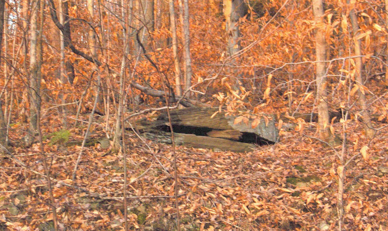
In the grid, looking through the 2 boulders as though they are pile-gap-pile:


Notice the pile in the foreground in the previous picture? Here is a close up of that pile. If you remove the tree and the years of accumulated leaf cover, I wonder if this was intended as an aperture?


Some of the piles on the other side of the two boulders:


When I was at this site the first time - when it was dark with leaf cover - I counted 9 piles as I stood in one spot.

This is looking down across 3 of the most prominent piles:


Here 2 shots of 2 of the piles, looking back toward the pile-gap-pile boulders. Notice the similar construction in the piles:


The last pile in the line of 3, which stood out the most, is actually rocks on a boulder. Notice how large they are:


And, I wonder if the aperture here is intended, as well?


This bank has a lot of features. I only focused on some of the more obvious piles in this post. Eventually, I will map as much of it as possible. Once I do, I'll post again on this site.

For now, I have some more photos of this area, which includes updates on the wall bulge and large cairns. As I keep going out to this site, I am able to see more, to gather more information, and to find things that I missed the first time I was out. Some of these things are very obvious and I wonder how I could have missed them the first time!