That picture overlooks an area that has been clear cut and also quarried by the State. I believe the top of that part of the mountain that was quarried was red shale (I have some pictures which I may post later).
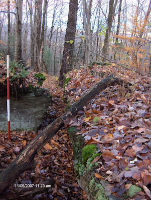
Here is a picture of part of the stone wall, so you can see how it snakes:

About 200 ft from where the first picture was taken, walking into the woods along the stone wall, there are two boulders or a split boulder:

The split faces 125 degrees true. Here is a picture from the back of the boulders - the side between the stone wall and the boulders:

Sitting where that large tree is growing, and looking out of the split, it looks like this:

Nice view!
Now that the leaves are off the trees, I was thinking this might be a nice place to sit and either watch the sun rise or the sun set. That means I'd have to get in there before sun up or leave after the sun goes down - when it's dark. That's okay, I could do it without a flashlight. All I have to do is follow the stone walls back to the dirt road where I parked (which may have been an Indian trail, based on the old stone foundation at the Northwest end of the road). I wonder if anyone else may have used these stone walls to find their way out here in the dark without a flashlight??
No comments:
Post a Comment